

Orange Historical Society


Orange, Connecticut


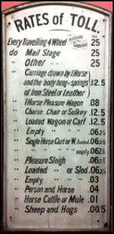
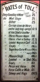
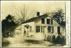
Route 34 -- Derby Turnpike in olden times!
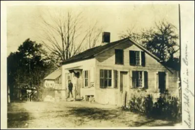
This
chart
used
to
hang
at
the
Derby
Turnpike
toll
house,
west
of
Dogwood
Rd.
near
the
Maltby
Lakes
in
Orange.
The
original
sign
can
be
seen
on
the
corner
of
the
house,
near
the
front
window
and
is
now
on
display
at
the
New
Haven Museum. The Academy Museum has a reproduction.
The
Derby
Turnpike
Company
was
formed
in
1798
to
construct
a
highway
from
York
Street
in
New
Haven
to
Derby
Landing
in
(East)
Derby.
It
was
discontinued
as
a
toll
road
in
1897.
A
sum
of
money
was
required
by
the
company
for a right of way with Orange paying $800.00.
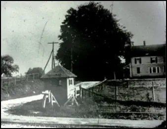
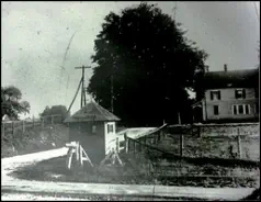
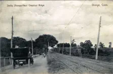
Grassy Hill Rd. trolley station on Derby Turnpike, looking south toward center of town. House to the right is still standing today.
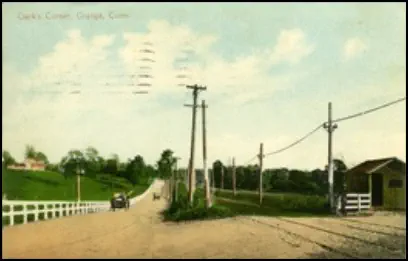
Trolley
station
on
Derby
Turnpike
at
Clarks'
Corner
looking
east
at
Orange
Center
Rd.
Its
name
was
derived
from
the
extensive
property
owned
by
members
of
the
Clark family running south for about one mile from the turnpike.
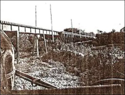
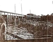
Trolley
viaduct
across
Wepawaug
River
valley,
on
south
side
of
Rte.
34
and
just
west of Mapledale Rd.
Joe Taylor Collection
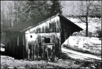
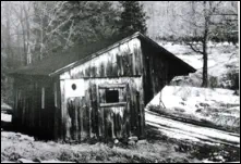
Racebrook Rd trolley station.
Mystery
solved!
The
Regional
Water
Authority
tells
us
that
this
was
not
a
trolley
station,
but
rather
one
of
three
sheds
used
in
the
Maltby
Lakes
tunnel
project
from
1909
to
1911.
Workers
would
sign
in
at
these
'offices'
and
pick
up
their
paychecks
there.
The
dilapidated
Racebrook
Rd.
building
stood
until
a
few
years
ago
when
it
was
torn
down
by
the
town.
According
to
RWA,
siblings
structures
still
stand
on
Dogburn Rd. and at the Wepawaug Reservoir.
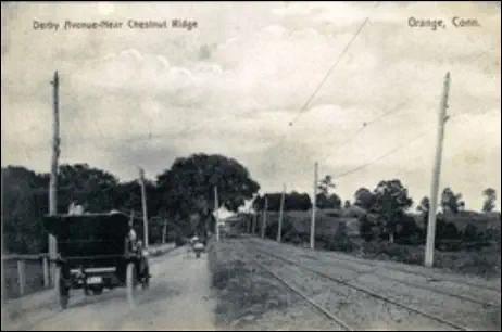
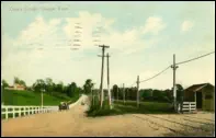
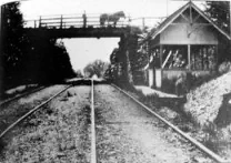
Derby
Turnpike,
Rte.
34,
looking
toward
Chestnut
Ridge
trolley
station.
Tracks
are
running
parallel
to
the
road
with
the
trolley
shelter
visible
in
the
distance.
The
New
Haven-bound
lanes
of
Rte.
34
today
were
built
on
the
old
trolley right of way.
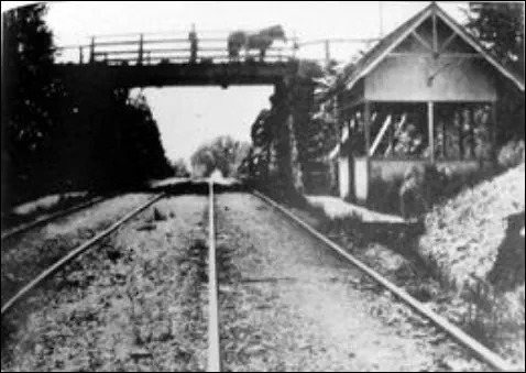
Chestnut Ridge trolley station, looking east toward overpass for road.
please email your old photos to images@orangehistory.org


Bryan Andrew


Gallery


Email us your old photos to images@orangehistory.org
Route
34
--
Derby
Turnpike
in
olden times!
This
chart
used
to
hang
at
the
Derby
Turnpike
toll
house,
west
of
Dogwood
Rd.
near
the
Maltby
Lakes
in
Orange.
The
original
sign
can
be
seen
on
the
corner
of
the
house,
near
the
front
window
and
is
now
on
display
at
the
New
Haven
Museum.
The
Academy
Museum
has
a
reproduction.
The
Derby
Turnpike
Company
was
formed
in
1798
to
construct
a
highway
from
York
Street
in
New
Haven
to
Derby
Landing
in
(East)
Derby.
It
was
discontinued
as
a
toll
road
in
1897.
A
sum
of
money
was
required
by
the
company
for
a
right
of
way
with
Orange
paying $800.00.
Grassy
Hill
Rd.
trolley
station
on
Derby
Turnpike,
looking
south
toward
center
of
town. House to the right is still standing today.
Trolley
station
on
Derby
Turnpike
at
Clarks'
Corner
looking
east
at
Orange
Center
Rd.
Its
name
was
derived
from
the
extensive
property
owned
by
members
of
the
Clark
family
running
south
for
about
one
mile from the turnpike.
Trolley
viaduct
across
Wepawaug
River
valley,
on
south
side
of
Rte.
34
and
just
west of Mapledale Rd.
Racebrook Rd trolley station.
Mystery
solved!
The
Regional
Water
Authority
tells
us
that
this
was
not
a
trolley
station,
but
rather
one
of
three
sheds
used
in
the
Maltby
Lakes
tunnel
project
from
1909
to
1911.
Workers
would
sign
in
at
these
'offices'
and
pick
up
their
paychecks
there.
The
dilapidated
Racebrook
Rd.
building
stood
until
a
few
years
ago
when
it
was
torn
down
by
the
town.
According
to
RWA,
siblings
structures
still
stand
on
Dogburn Rd. and at the Wepawaug Reservoir.
Derby
Turnpike,
Rte.
34,
looking
toward
Chestnut
Ridge
trolley
station.
Tracks
are
running
parallel
to
the
road
with
the
trolley
shelter
visible
in
the
distance.
The
New
Haven-bound
lanes
of
Rte.
34
today
were
built
on
the
old
trolley right of way.
Chestnut
Ridge
trolley
station,
looking
east
toward
overpass for road.

Orange Historical Society
Orange, Connecticut


Bryan Andrew


